V pondělí 16. září 2024 začala naše další
nová soutěž o nejlepší webovou stránku !!
Proto neváhejte a začněte rychle soutěžit o lákavé ceny !!
nová soutěž o nejlepší webovou stránku !!
Proto neváhejte a začněte rychle soutěžit o lákavé ceny !!
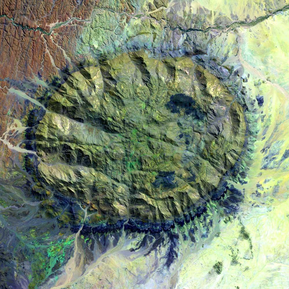
Soubor:Brandberg Massif Landsat Image.jpg
Z Multimediaexpo.cz
Velikost tohoto náhledu je: 600 × 600 pixelů
Obrázek ve vyšším rozlišení (rozměr: 1 000 × 1 000 pixelů, velikost souboru: 215 kB, MIME typ: image/jpeg)
Fotografie + Description:
- English: Satellite image of the Brandberg Massif, Namibia. Original figure caption: “Brandberg Massif is a dome-shaped granite intrusion that covers 250 square miles (650 square kilometers) and rises 1.6 miles (2,573 meters) above its surroundings in the central Namib Desert. Brandberg Massif is an important habitat for high-altitude savannah species and is of great archaeological interest due to the many prehistoric cave paintings found among its granite cliffs.”
- Deutsch: Satellitenbild des Brandberg Massivs, Namibia. Original Bildbeschriftung (modifizierte Übersetzung): Das Brandbergmassiv ist eine kuppelförmige Granit-Intrusion, deren Ausbiss sich über 650 Quadratkilometer erstreckt und sich 2.573 Meter über sein Umland in der zentralen Namib-Wüste erhebt. Das Brandberg-Massiv ist ein wichtiger Lebensraum für Pflanzen- und Tierarten der Hochlandsavanne und von hohem archäologischem Interesse aufgrund der zahlreichen frühgeschichtlichen Höhlenmalereien in seinen Granitklippen.
- Date: 10 September 2002 (“acquisition date”)
- Author: USGS
+ pochází z Wikimedia Commons, kde má status – This image is in the public domain in the United States because it only contains materials that originally came from the United States Geological Survey, an agency of the United States Department of the Interior.
Historie souboru
Kliknutím na datum a čas se zobrazí tehdejší verze souboru.
| Datum a čas | Náhled | Rozměry | Uživatel | Komentář | |
|---|---|---|---|---|---|
| současná | 11. 8. 2014, 07:05 | | 1 000×1 000 (215 kB) | Sysop (diskuse | příspěvky) | (Fotografie+) |
- Editovat tento soubor v externím programu (Více informací najdete v nápovědě pro nastavení.)
Odkazy na soubor
Na soubor odkazuje tato stránka:


