V pondělí 16. září 2024 začala naše další
nová soutěž o nejlepší webovou stránku !!
Proto neváhejte a začněte rychle soutěžit o lákavé ceny !!
nová soutěž o nejlepší webovou stránku !!
Proto neváhejte a začněte rychle soutěžit o lákavé ceny !!
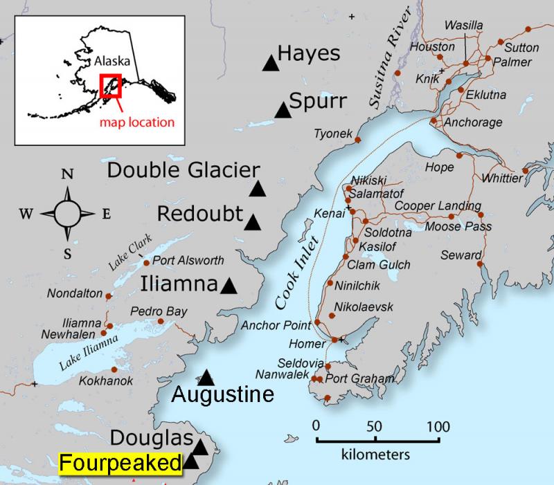
Soubor:Fourpeaked-map1.jpg
Z Multimediaexpo.cz
Velikost tohoto náhledu je: 684 × 599 pixelů
Obrázek ve vyšším rozlišení (rozměr: 800 × 701 pixelů, velikost souboru: 82 kB, MIME typ: image/jpeg)
Mapa + Description:
- English: AVO map shows the location of Fourpeaked volcano
- Source: Map created by Seth Snedigar and Janet Schaafer for the United States Geological Survey's Alaska Volcano Observatory and the Alaska Division of Geological & Geophysical Surveys
- Author: Seth Snedigar and Janet Schaafer for the United States Geological Survey's Alaska Volcano Observatory and the Alaska Division of Geological & Geophysical Surveys
+ pochází z Wikimedia Commons, kde má status – This image is in the public domain in the United States because it only contains materials that originally came from the United States Geological Survey, an agency of the United States Department of the Interior.
Historie souboru
Kliknutím na datum a čas se zobrazí tehdejší verze souboru.
| Datum a čas | Náhled | Rozměry | Uživatel | Komentář | |
|---|---|---|---|---|---|
| současná | 12. 7. 2022, 15:04 | | 800×701 (82 kB) | Sysop (diskuse | příspěvky) | (Fotografie + ) |
- Editovat tento soubor v externím programu (Více informací najdete v nápovědě pro nastavení.)
Odkazy na soubor
Na soubor odkazují tyto 2 stránky:


